
Daily · Original
Travle Strategy: Routes, Borders and Bridges
Find a path from one country to another.
EDITOR'S TAKE
It makes you picture the map rather than memorize it. Finding a tidy route is one of those small, deeply satisfying wins.
US state map · Geography game

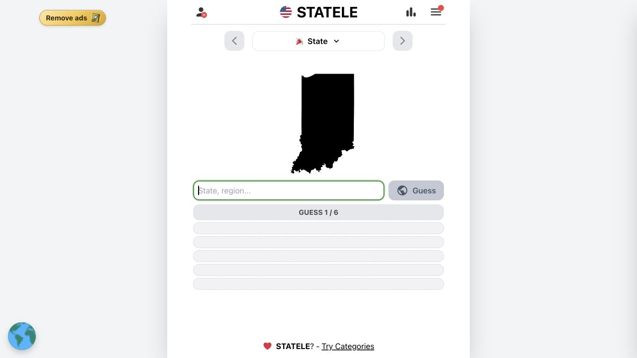 Statele
THE ORIGINAL DAILY GAME
Guess the US state from its outline in six tries. The original game opens on its publisher’s website in a new tab.
THE SHORT VERSION
Statele shows the silhouette of a US state and gives you six guesses to identify it. Wrong answers return distance, direction, and proximity clues, so even an unfamiliar outline can become a solvable map problem. The official archive also lets you practice past puzzles.
| Goal | Identify a US state from its map outline within six guesses. |
|---|---|
| Category | Geography games |
| Guesses | 6 |
| Clues | Outline, distance, direction and proximity |
| Past puzzles | Official archive |
| Where to play | Statele on the publisher’s website |
WHY WE PUT IT ON THE SHELF
An outline might leave you blank, but a single good guess turns it into a map you can reason through. The archive makes it easy to get better without waiting for tomorrow.
Find a path from one country to another.
It makes you picture the map rather than memorize it. Finding a tidy route is one of those small, deeply satisfying wins.

A silhouette is all you need to start.
A country outline looks impossible for about ten seconds, then the directional clues start turning it into a solvable little trip.
Read an export map and identify the country behind it.
A map game with a wonderfully odd clue: what a country exports. It feels like learning something real while still being a puzzle.

Use ingredients and cooking clues to place a dish on the map.
Food is a friendly way into geography. One ingredient or cooking method can send you somewhere completely unexpected.

Find the mystery country by following the heat.
The first warm patch is a thrill, but the real pleasure is realizing two distant guesses can tell you more than five neighboring ones.

Four puzzles. Twelve orbs. Six to win.
Four small puzzle moods in one place means you can skip the one that is not clicking and still have a good break.
Statele is a daily map puzzle about the United States. You see the outline of a state, make up to six guesses, and use geographic feedback to work toward the answer. This independent guide explains what the clues actually say, how the official archive helps you practice, and when to switch from recognizing shapes to reasoning from the map.
“You have six guesses to find the Statele!”
The official rules describe distance, direction and proximity feedback. The official menu links to an archive; both were checked directly.
The official game presents a state silhouette without naming the state. Type a location into the guess field and select it from the suggestions. If the answer is wrong, the game does more than mark it incorrect: it shows how far your guess is from the target, a direction to travel, and a proximity indication. You have six attempts to identify the state. This is a daily puzzle, so the shape you see will change with the publisher’s schedule.
It is worth looking at the outline before using any guesses. A very long coastline, a narrow peninsula, or an unusually straight border may be enough to recognize a place. But many inland states look more similar than memory suggests. Treat the silhouette as a first clue, not as a test you must pass before the useful feedback starts. CasualAtlas links to the publisher rather than hosting a copy of the puzzle.
After a wrong guess, read distance and direction together. Distance tells you how large a correction to make; direction tells you where to look next. If a central guess points far northeast, move to a genuinely different part of the map. Guessing the next state over would spend a turn without testing much. If the distance is short, nearby borders and similarly shaped neighbors become more useful than a second cross-country jump.
Proximity is a helpful summary, but the number is not a replacement for the map. Two places can feel close on a screen while still lying in distinct regions, and a state with a large footprint can make intuition about its center unreliable. Ask what region remains possible after every clue. The aim is not to memorize a single opening state; it is to use each attempt to shrink the plausible area.
Start with the silhouette. Separate distinctive coastal shapes from broad inland shapes, and check whether the borders are mostly straight, curved, or broken by water. If you cannot identify it, a central state such as Kansas is a reasonable first probe because its position helps divide the country. The direction clue can send you east or west without committing to an edge too early.
For a second guess, make a meaningful geographic move based on the first clue, not a small adjustment chosen at random. If the target still seems far away, a state in the indicated region can test your hypothesis. By the third guess, compare the two distances and directions and consider the likely corridor between them. You may still have several candidates; this is a method for improving information, not a promise that the answer will always be obvious after three moves.
Yes. The official Statele menu includes an Archive link. That makes the game more useful for learning than a strict one-puzzle-per-day format: you can revisit earlier silhouettes and notice which regions repeatedly confuse you. Use the publisher’s archive rather than a third-party answer page when you want actual practice. The puzzle counter on the live site changes over time, so an old count in a guide is not a reliable measure of how many rounds are currently available.
A good practice session does not have to be long. Try a few archived states from different regions, then write down what you missed: a coastline, a river border, a northern tier position, or a direction clue you interpreted too literally. The next time a similar outline appears, you have a more specific memory to reach for. If your goal is to learn rather than preserve a perfect streak, the archive is the most valuable feature of the official site.
Statele and Worldle come from Teuteuf, but they ask different questions: Statele focuses on US states, while Worldle asks for a country or territory. Both begin with a silhouette and turn wrong guesses into geographic guidance. Globle hides a country without giving you its outline first; instead, guessed countries receive warmer or cooler colors according to how close they are. If Statele feels too local, Worldle widens the map. If outlines are your least favorite clue, Globle changes the entire deduction style.
The distinction matters when choosing a game to practice. Statele can build an internal map of the US; Worldle rewards recognizing national boundaries and global position; Globle rewards choosing far-apart probes and reading relative heat. Do not assume that a skill learned in one transfers unchanged to another. They share a geography theme, not an identical answer format or clue system.
Six. The official game shows the current attempt and a total of six.
The official rules describe distance, direction and proximity feedback for each wrong guess.
Yes. The silhouette is the first clue on the daily game screen.
Yes. The publisher’s menu links to an Archive for earlier puzzles.
No. They share the Teuteuf publisher, but Statele focuses on US states and Worldle on countries or territories.
No. Globle is a country hunt using color heat; Statele begins with a US state silhouette.
The official archive lets you revisit earlier Statele puzzles. Check its current availability on the publisher site.
No. This is an independent guide with a link to the original game.
No. A central guess is useful when the outline is unfamiliar; a recognized silhouette deserves a direct answer.
The publisher offers the daily game on its site and advertises an optional Passport product for an ad-free experience.
Rules and live game: official Statele website . CasualAtlas is an independent guide and is not affiliated with the publisher.